Key Highlights
- Google Maps Immersive View for routes features released at I/O 2023
- Offers real time street view, transport mode, and more
- Features Time Slider to show routes during weather changes
- Stable update yet to be released
At the I/0 2023 event, Google unveiled a slew of advanced AI features for its range of services alongside the new Pixel product lineup. Android 14, Google Bard, and intuitive features for Gmail and Google Maps were also introduced at Google’s annual developer conference. One such interesting and useful feature that Google announced at the I/O 2023 event is the Google Maps Immersive View feature which will allow users to see real-time traffic status and also weather updates.
Google Maps Immersive View For Routes Feature: What Is It?
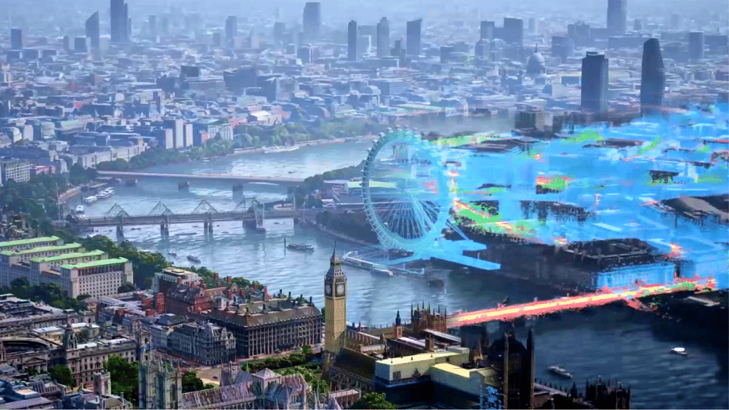
The Google Maps Immersive Street View for routes feature introduced at the I/0 2023 event is an AI feature that uses complex algorithms to merge billions of aerial and Street View images using computer vision and AI. This helps Maps to develop a comprehensive digital representation of the globe and provide all the required information that the user needs in one spot.
Also Read: Find Nearest Grocery Store: Here’s How To Locate Closest Grocery Store Using Google Maps
Google Maps Immersive View For Routes: How To Use?

Google Maps Immersive View for routes features is yet to be added to the Maps app (both Android and iOS). The rollout is expected as an OTA in the coming months. However, the exact availability remains uncertain. But we believe Google will commence the phased roll-out of the Maps Immersive View for routes soon.
Once the feature is live, users will be able to use it with just a few taps. As for what all Google Maps Immersive View For Routes feature offers, take a look below:
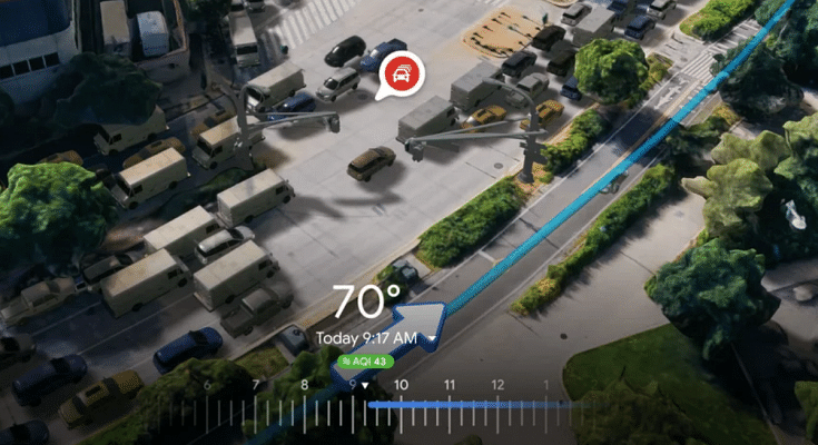
Google Maps Immersive View for routes is designed to show real-time route information including an immersive preview of the route being traveled and the mode of transport such as driving, biking/cycling or walking before the journey begins.
Besides the route preview and mode of transport, users will also get to see immersive real-time images of the parking spots, bike, and pedestrian lanes, and also intersections in a multidimensional view. This feature will further allow Maps to show the approx. number of cars and other vehicles on the road in real-time by using AI.
To further enhance the navigation feature, users will also get the option to check the air quality and how the track becomes during changes in weather. This can be done using the time slider option in the Immersive View Maps For Routes.
Also Read: Google Maps Privacy: How To Blur Or Delete House Or Any Other Image In Google Maps Street View